
Garmin hand held on bike?

#2
 07-21-2009, 09:03 AM
Road Warrior
Join Date: Aug 2008
Location: Metro Denver
Posts: 1,345
Likes: 0
Received 0 Likes
on
0 Posts

I love it for the fact that I can download the trip data and create altitude graphs, etc.
 (yeah, I'm a computer nerd for sure).
#3
07-21-2009, 09:04 AM

Road Master
I have no experience with it, and i hope you aren't suggesting to pull it out of your pocket to look at it while riding. That sounds awfully dangerous to me. its bad enough we have to take out eyes off the road ahead to look at these things, but taking your hand off the bars and your eyes off the road, i dont' like the sound of that.
Now if it was something you could mount, then i don't see why not other than smaller display, etc. As long as you are familiar with the operation of the unit, i'm sure it could be done
Now if it was something you could mount, then i don't see why not other than smaller display, etc. As long as you are familiar with the operation of the unit, i'm sure it could be done
#4
07-21-2009, 09:06 AM
Tourer
Join Date: Sep 2005
Location: DC
Posts: 415
Likes: 0
Received 0 Likes
on
0 Posts
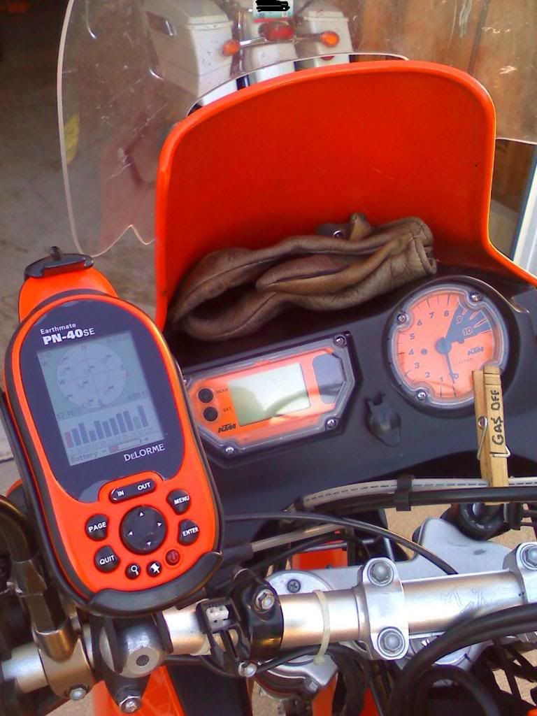
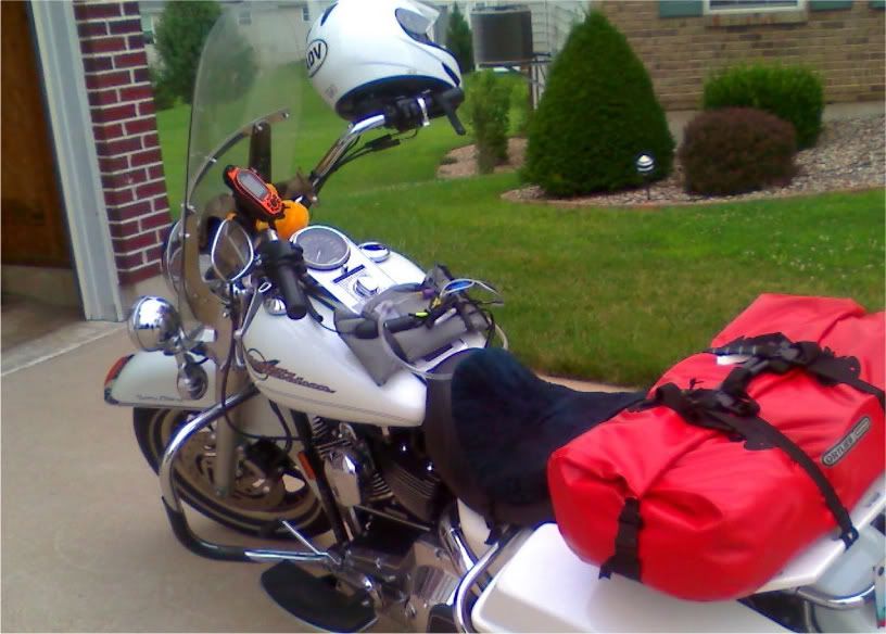
I had a Garmin handheld on my bike for a while before Santa brought me a Zumo. It's not a bad way to go, cost-wise, and they're designed for hiking so they're waterproof and shock-proof. I used a RAM handlebar mount and it worked fine. Cons: really tough to do your button-pushing safely while riding, small screen and tough to work through the menus in motion.
If you just want a moving map and don't do much besides go point A to B without much changing en-route, it's not a bad option. But if you can afford a Zumo, I'd go that route.
If you just want a moving map and don't do much besides go point A to B without much changing en-route, it's not a bad option. But if you can afford a Zumo, I'd go that route.
#6
07-21-2009, 10:38 AM

Road Warrior
Join Date: Jan 2006
Location: Waynesville, NC
Posts: 1,808
Likes: 0
Received 0 Likes
on
0 Posts
#7
07-21-2009, 10:45 AM

Trending Topics
#8
07-21-2009, 10:51 AM

I used one for a while. It actually has a few advantages over the ones designed for cars or bikes.
I could program an entire trip, waypoints and all, on the computer and upload to the Garmin. I could copy and save a random trip and follow it in reverse if desired.
There was a lot more map flexibility like unlimited altitude views and altitude readings on the ground.
I could make the whole screen a digital speedometer to calculate accuracy or replace the speedo when it temporarily broke.
Negatives, of course, include small monochromatic screen and lack of typical driving software. Too bad the functionality of the Zumo type units doesn't also include the depth of function that some of the others have. Info from those designed for hiking, sailing and aviation have lots of functions that are lacking in the driving-only ones.
#9
07-21-2009, 11:30 AM
I've read that a hand held doesn't make for a good vehicle navigation system and vice-versa. I have a bike mount for my Megellan Explorist and found the statement to be true. I used it mostly for back road (dirt road) exploration and experienced some of its pros and cons.
The live map function was very handy. The compass kept my going in the correct general direction when I came to an intersection. The electronic "bread crumbs" allowed me to review where I had been after I returned home.
As far as cons, one of the biggest was I didn't have the turn by turn option so it performed well as a map but couldn't "tell" me how to find home. The close up detail was excellent but with the Magellan, the detail would be deleted after I zoomed out to find where I was. The dirt road intersection that showed close up was not displayed when I zoomed out so the triangle showing my location was exact but only displayed that I was out in the middle of "nowhere"! I relied on the compass function more often than not to decide my next turn. Another con is the small display but it wasn't a big inconvenience; it's just that a larger display is easier to use.
Even though I still carried the detailed county maps with me, the hand held was a lot more convenient than stopping and looking at a map. (I have never lost satellite coverage due to tree canopies overhanging the road.) I have never used a hand held with a turn by turn program but that would make it a lot more versatile but I don't think it would come close to a road navigation gps.
I have since gotten a Garmin road nav system and there's no comparison.