Zion Nat'l Park
#11
 03-11-2009, 11:27 AM


Intermediate
Join Date: Aug 2007
Location:
Posts: 38
Likes: 0
Received 0 Likes
on
0 Posts
#12
03-11-2009, 01:20 PM
Join Date: Jun 2006
Location: Ak-Tenn
Posts: 2,812
Likes: 0
Received 0 Likes
on
0 Posts
#13
03-11-2009, 01:52 PM

Hey guys Im goin to utah the last full week of june.I m comin form the south rim and heading to hurricane ut for 1st nite via 89a and 389. goin next day to zion then 89 n to hwy 12 to torrey.stoppin at escalante capitol reef etc. next day headin to moab & arches via24e to 95 s stoppin along way at needles etc. leave the next day via128 to I 70 cant wait
#14
03-11-2009, 01:55 PM
Check this web site for some fantastic pics of the routes.There are 2 pages be sure to hit the links for the pics
http://www.cyclerides.com/ridephotos...2/utahday1.htm
http://www.cyclerides.com/ridephotos...2/utahday1.htm
#15
03-11-2009, 02:00 PM

Road Master
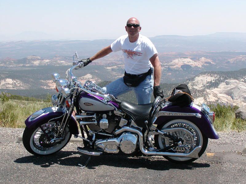
By the way, the pic in my sig is from the Cedar Breaks overlook just up the hill and east from Cedar City, UT.
#16
03-11-2009, 02:04 PM
Road Master
Rich, it's like going to the Smithsonian and trying to see everything in one day. There is so much great riding there and so much diversity. Everything from tall Ponderosa Pine forests with nice gently twisting roads to red rock formations to the tunnel in Zion (LOVE IT) and the HooDoos in Bryce Canyon.
#17
03-11-2009, 02:18 PM
Man, you guys know the road #'s a lot better than I do. When I was first on those roads, most were still dirt and had a lot more windies (is that a road or a fart?) There were more names than numbers.
Lover's leap SW of Blanding, Isabelle hill West of Mexican Hat, Up the river road, down the river road, LaSalle loop road through Castle Valley, Squaw Tit Mountain (OOPs - politacally incorrect name - called that by old cowboys. Has been renamed Round Mountain since the Environmentalists have taken over Moab.) Lots more names and roads in that country. Don't miss the San Rafael Reef over by Torey. Small area, but great petroglyphs and canyon. Nice Motel on the West side of town.
If you can't tell, I was born in Moab and lived in the SE Utah and SW Colorado country most of my life. When I was growing up in Moab, about every fifth vehicle down Main Street was an oar truck carrying Uranium oar. No sprocket heads. '57 Chevies, Mopars and Mustangs were the order of the day. Four wheel drive and horse trails instead of bicycle trails.
But I digress.
Don
Last edited by DonM; 03-11-2009 at 02:33 PM.
#18
03-12-2009, 12:29 AM
Once you've got them hosted somewhere then use the "Insert Image" button (It's the little icon with a yellow background, sun, and mountain). Then post the URL and it will load the picture for you.
One other thing I should mention, when you head for 4 corners then make sure you're tank is topped off. The ride from Hanksville to Blanding is about 126 miles, and I don't think there's any gas spots on the road in between.
Here's a couple more shots of the type of scenery you'll encounter. This first one is between Cedar City and St George but off the Interstate. It's taken outside of Gunlock, UT, which is near Gunlock State Park
http://www.utah.com/stateparks/gunlock.htm

These next two are east of St George as you head for Kanab, UT. It's approximately south of Zion National Park, so it gives you an idea of how varied the terrain/scenery is around here.


#19
03-12-2009, 01:37 PM
Tourer
Join Date: Jul 2006
Location: Antioch, CA
Posts: 403
Likes: 0
Received 0 Likes
on
0 Posts
In Moab plan a drive through Canyonlands NP also, after you visit ARches NP. Canyonlands is an entirely different experience. Plan a full day, take your time and hit the visitors center and all the vista points.
For specific info about the National Parks go to www.nps.gov, then click on the link for the park your interested in.
For specific info about the National Parks go to www.nps.gov, then click on the link for the park your interested in.
#20
03-12-2009, 04:02 PM

I can send a few pics if you like, just say the word.