Well buddy, if you do come south in August, I'll have a spot for you. I just brought my adventure bike project out here last week - Silverwing GL650. Of course the carbs got all plugged up so it's in the shop getting rebuilt. Battery was shot, I have to dig out the extra wheels and get the off road tires mounted. Hope to have it ready for winter riding here in a few weeks.
It is time to switch up "Cameras"... by that I mean my iPhone... I have been using an iPhone 7 Plus for several years... and it has worked fine for many pictures I take for Journeys... but it does have its limitations. Also, the phone is getting long in the tooth and even though it has the same OS as the 12, it certainly does not have the capability of it... after a bit of research I am going to get an iPhone 12 Pro... it will save in RAW, and JPEG... so i will have the ability to use the RAW image in Photo shop if I want to, for fun and for printing... It has pretty good specs.. 460 dpi, 2532 x 1170 Pixels... F/1.6 lens... Wide, regular and telephoto capability... 12 megapixels... of course I am an old school "Glass" guy, so it will be interesting to see how it compares to my Sony once I get it and do some straight up comparisons in Photoshop and Printing... I am sure it will not have the same capability's of the my Sony NEX 6 and will still take it when i am out and about... now that I am "Semi-retired"... I will have more time for my main hobby, which is photography and printing... I was out yesterday and shot a few with my iPhone, but not my camera... I did not like the flat light of the grim winter day... Here a few...
the light really sucked... these are right out of the can... it will be interesting to see what the 12 Pro will do with this kind of light...
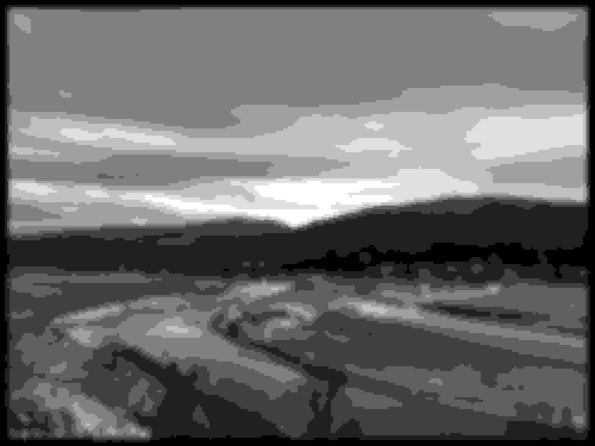
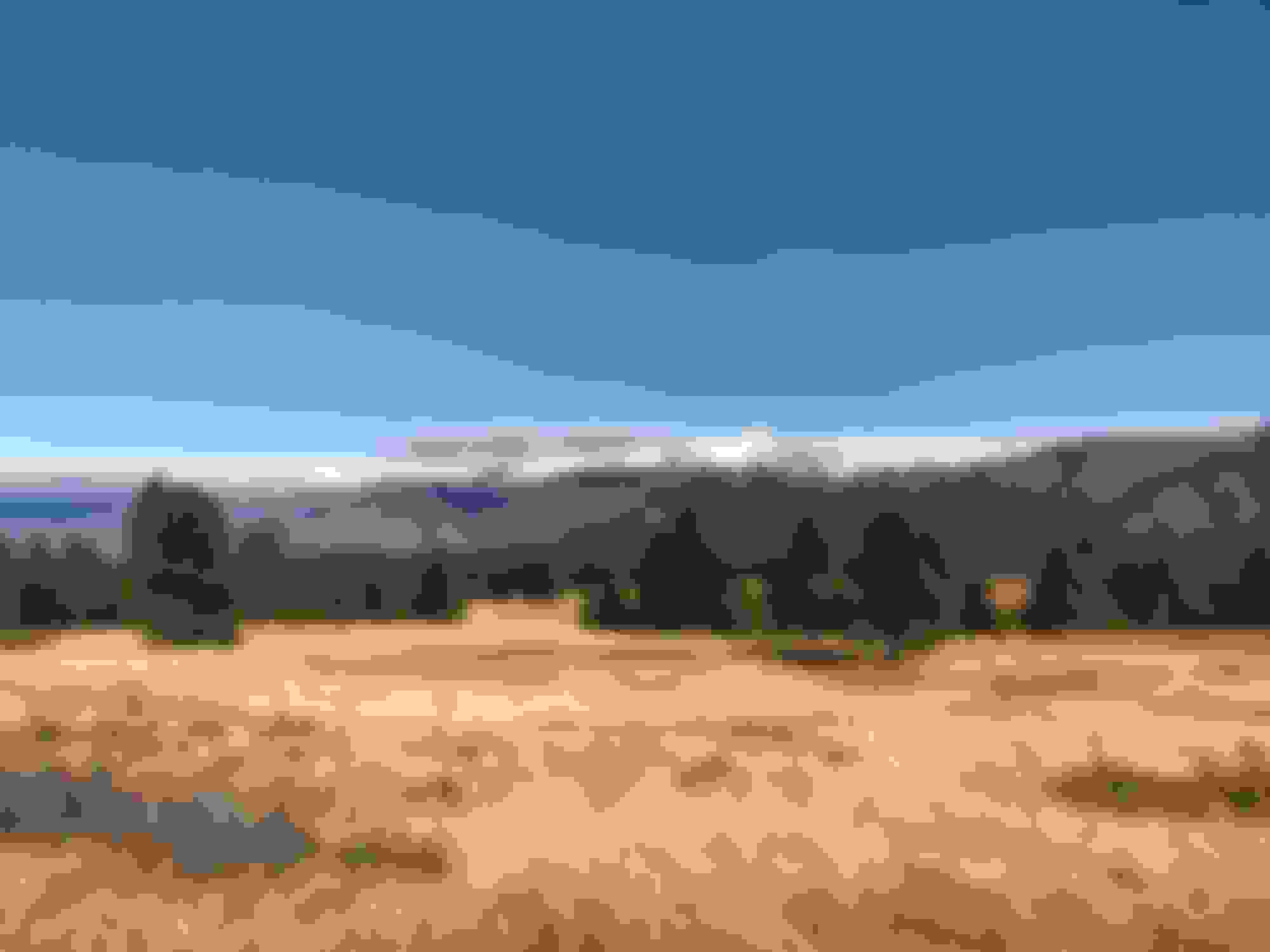
... but it was nice to get out an about in The Bleak Mid Winter... Kootenay River, just south East of Cranbrook a bit... if you know where to look, you can see the Kimberley Ski hill... it is on the far range, just above the distant hay shed in the middle of the image.
First test on the iPhone 12 pro... nothing to look at as it is just a preliminary test and I too lazy to actually go outside..., but I shot the following image with my old iPhone 7 Plus, which is JPEG... the new phone in JPEG... and then in RAW... and my Sony in RAW.
Old phone... JPEG image was 3.6 mb large...
My Sony Camera... in JPEG, 6 mb..... in RAW, 17 mb... saved as a PhotoShop image... 48 MB
New phone ...in JPEG, 5.3... Now this is interesting... in RAW, 27 MB.... saved as a PhotoShop image, 135MB... over 2 1/2 times the material to work with than my DSLR Camera... I can hardly wait to get out into the field to work with it... It will be interesting to see the differences between the 12 and the Sony when I start to use telephoto, and shoot into the sun.
iPhone 7... shot JPEG 3.6 MB...
iPhone 12pro... shot in RAW, converted to a PSD file... then saved as a JPEG... 6.6 MB...There are trees in the first row just across the field that only exist in the old phone image as shadows...
The constant dull sky, gloomy days, is killing me. It's bad enough to not be able to get in some wind therapy, but to not have any good shutter therapy really makes for a bit of mental madness.
I went for a drive in the Rubicon yesterday, hoping to find some good photo ops, however the overcast sky was relentless and visibility was getting worse as time went by. I did manage to find me a Bald Eagle, high in a tree, along the Rock River, which is still a pretty rare sight.
Canon 5D Mark IV
Canon EF 300mm F/4L IS + 1.4x Teleconverter
1/2000 @ F8
ISO 500
But I may as well have been shooting in black and white. Too much doom, and gloom for that matter, lately.
I'm hoping for some sunshine, sooner than later, so I can get over to the Mississippi River, lock and dam 14, to try and catch some shots of Bald Eagles fishing. I have yet to get "that" shot.
Often highway 3 in BC is overlooked as a bucket list road… but it is one… 7 Mountain passes, dozens of lakes, lots of small little towns, a few small cities… lots of places to eat, camp… and the views from some of it are nothing less than spectacular.
A great loop would be from Fort McCloud in Alberta to Abotsford in BC, then cross into Washington state, and take Hwy 20 East towards Highwy 2, then head to Kalipsell, and up and over the Going to the Sun Road. This would be a great four or five day run.
I have ridden every mile of this loop, just not on one run… and on the BC side of it, I have been over some of it literally thousands of times, as much of it was my route in my truck driving days.
This will be mostly a pictorial essay with descriptions, but I really don’t have any of the first bit from Fort McCloud to Fernie… but that part of has some great places to visit… Just a bit North East of Fort McCloud is Head Smashed in Buffalo Jump… very worthy of a side trip.. then east a bit to the Frank Slide, also worth a stop to look see… if you feel like a short hike, there are some small open pit mines that the Indians mined over 6,000 years ago… then you go up and over the Crowsnest Pass…and drop into Sparwood… there is a nice little excursion North of Sparwood to Elkford… about an hour up and back all in… a nice little ride in the Rocky Mountains… a little bit further north and you can get into the Fording River Valley.
Then you get to Fernie… and the pictures start there… (I really have nothing to do until spring, so this will be a thing I will spool out a bit at a time over the next 6 to 8 weeks)…
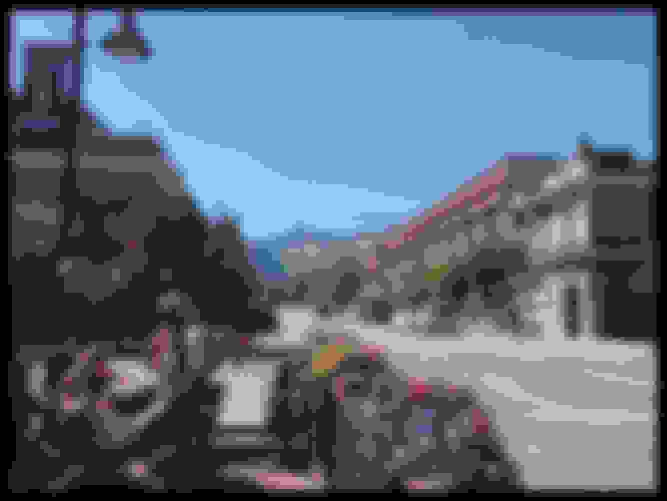
Downtown Fernie... this is my go-to Bagel shop when I am there... Big Bang Bagels... That is the Ski Hill directly down the road...
... Heading west from Fernie, looking North...
... the tunnel... this road is built on the old railroad bed... hence the rough looking hole in the wall... when they moved the railway to the other side of the Elk River, the use the bed for the new vehcile road... if you wonder whey the road is so flat for about 20 miles, that is why...
... in Jafrey there is a nice little pub on the East side of the road... good food... Jafrey Pub & Sunrise Grill... from my Buell days...
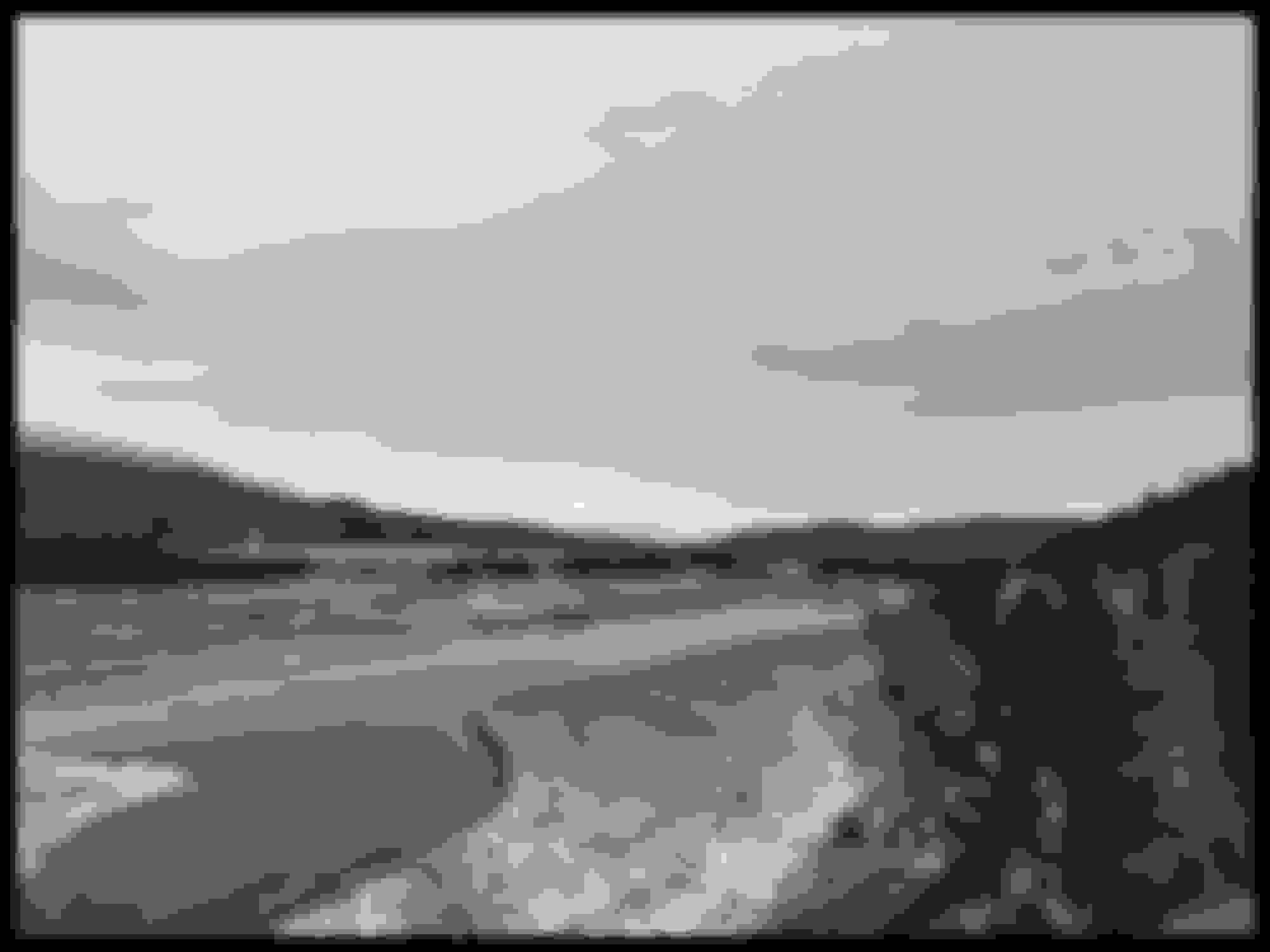
... Bull mountain with a shroud... this is take at the Kootenay River...
... in the valley heading towards Cranbrook, and looking at the Rocky Mountains.
This is the loop... from Ft McCloud to Hope, it stays on Hwy 3... then it jumps to the north side of the Fraser river all the way to Mission, and heads south to the Border... once you cross the border you stay on that road all the way to Hwy 20 and you head east.. and towards Winthrop... you can see that I could not trace the road all the way, as the top of the mountain pass will be closed in the winter, usually opening up in May... then on Hwy 20 all the way to just east of Sandpoint, and then onto Hwy 2.. but just a short distance, as the road from Sandpoint to Libby is a much nicer Motorcycle road... once in libby, you head north up the East side of the lake... if you feel adventurous, once you get to Libby you can head up and over the mountains to Yahk Montana... Once in Eureka, you head south to Whitefish, then to Glacier, and then up and over the Going To The Sun Road... once in St. Marys head to the Chief Mountain border crossing... then into Waterton National Park... it is a great place to camp.. then up to Ft McCloud to finish the loop... Or off you go to Sturgis... the entire loop is about a 1,500 mile rounder... I would plan on 5 - 300 mile days... if you have time, take two days to get from Creston back to Castlegar, and do Creston/Crawford Bay/Kaslo/New Denver/Nelson/Castlegar loop.
Have you seen (or Own) the Destination Highways British Columbia book?
Not that you need a book to find good roads, but it describes them in detail and ranks them also. DHBC1 is the stretch of 3A north of Creston to Crawford Bay. A buddy and I rode it southbound on a wide loop from Ft Mac to Sturgis 2015. They don't do Northern BC but the island, okanagan Kootenays and such is there.
WA 20 is great! We (my wife and I) like to stay in Leavenworth but need to try Winthrop some time. Mind you she also likes Cle Elum for the Mexican restaurant in town.
This is the loop... from Ft McCloud to Hope, it stays on Hwy 3... then it jumps to the north side of the Fraser river all the way to Mission, and heads south to the Border... once you cross the border you stay on that road all the way to Hwy 20 and you head east.. and towards Winthrop... you can see that I could not trace the road all the way, as the top of the mountain pass will be closed in the winter, usually opening up in May... then on Hwy 20 all the way to just east of Sandpoint, and then onto Hwy 2.. but just a short distance, as the road from Sandpoint to Libby is a much nicer Motorcycle road... once in libby, you head north up the East side of the lake... if you feel adventurous, once you get to Libby you can head up and over the mountains to Yahk Montana... Once in Eureka, you head south to Whitefish, then to Glacier, and then up and over the Going To The Sun Road... once in St. Marys head to the Chief Mountain border crossing... then into Waterton National Park... it is a great place to camp.. then up to Ft McCloud to finish the loop... Or off you go to Sturgis... the entire loop is about a 1,500 mile rounder... I would plan on 5 - 300 mile days... if you have time, take two days to get from Creston back to Castlegar, and do Creston/Crawford Bay/Kaslo/New Denver/Nelson/Castlegar loop.
We've been on a lot of those roads from north of Spokane to the east. One trip we came up through Helena and stayed in Lethbridge. Rode to Pincher Creek, up to Longview, 541/40 to Ozada then into Canmore. I hope we can do the 541/40 ride again it was beautiful.
British Columbia is the most beautiful province or state I’ve been. Worked in Vancouver for 3 years in the mid 90s.
Every weekend was a new venture. Ferry to Victoria. Drive up Howe Sound. Rent Harley and go into Okanagan. Float plane trip to islands for fishing lodge. Salmon fishing. Getting off work and night skiing in the North side. Hiking. Mountain Climbing. Whistler. Blackcomb. Garibaldi. Nelson....
It’s like living in California, Washington, and Colorado all-in-one, and then some.
Would have moved there but wife had business in states and daughter in high school.
 12-06-2020, 07:06 PM